UNAM expands earthquake monitoring to Mexico's historically underserved northern states
The National Autonomous University of Mexico (UNAM) announced this week plans to construct 58 new seismic monitoring stations nationwide, with a significant focus on the historically under-instrumented northern regions of the country.
The expansion will concentrate on the Baja California peninsula and the border states of Sonora, Chihuahua, Coahuila and Nuevo León — areas that have long been underserved by earthquake monitoring infrastructure.
This initiative represents the third phase of an expansion project that began in the first decade of the 21st century. The new stations will share data between UNAM's Institute of Engineering, the National Seismological Service, and the National Center for Disaster Prevention (Cenapred) through fiber optic networks and radio links.
Dispelling myths about northern seismic activity
Northern Mexico is frequently perceived as low-risk for earthquakes, but Leonardo Ramírez Guzmán, head of the seismic research unit at UNAM's Institute of Engineering, challenged this assumption. "There is a misconception that earthquakes don't occur in those regions," he said. "However, seismic activity is also recorded there, so having more stations will allow for more precise identification and study of these events."
Historical records support this concern. The largest recorded earthquake in northern Mexico was an approximately magnitude-7.4 event in 1887 that ruptured the Pitaycachi fault in northeastern Sonora, with tremors felt as far as Albuquerque and Santa Fe in New Mexico. More recently, the magnitude-7.2 El Mayor-Cucapah earthquake struck northeastern Baja California on April 4, 2010, killing four people, injuring approximately 100, and affecting an estimated 25,000 residents in cities like Calexico and Mexicali.
A 2007 study documented 148 earthquakes in northeast Mexico between 1787 and 2006, with 118 events ranging from magnitude 2.4 to 6.5 recorded between 1847 and 2005 across parts of Chihuahua, Durango, Coahuila, Nuevo León and Tamaulipas.
Geological vulnerability in Baja California
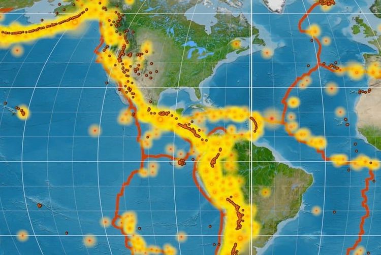
The focus on Baja California is particularly significant given the peninsula's position along major fault systems. The region's faults form part of the Pacific-North America plate boundary, extending the San Andreas fault system southward. Seismic activity concentrates along the El Descanso, Coronado-Banks, Santa Catalina, Bahía Soledad and San Isidro faults.
Current monitoring infrastructure
The monitoring stations and their associated computer systems collect seismic data and provide rapid damage-assessment tools that deliver near-real-time information for emergency response teams, though they do not predict earthquakes.
Currently, Guerrero leads the nation with 34 monitoring stations, followed by Oaxaca with 30 operational stations and two under construction. Mexico City maintains approximately 100 stations, ranking among the world's densest monitoring networks alongside Tokyo and Los Angeles. The capital's sensors are so sensitive they even detected an "artificial earthquake" generated by crowd reactions after Mexico scored a crucial goal at Estadio Azteca during a World Cup match.
The expansion project receives funding from the Ministry of Security and Citizen Protection with support from Cenapred.
Advanced monitoring capabilities
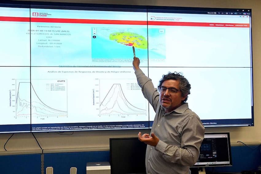
Beyond building new stations, UNAM is implementing a platform that generates earthquake intensity maps less than an hour after tremors occur. The system proved its accuracy following a magnitude 6.5 earthquake that struck Guerrero on Jan. 2, when shake-intensity readings taken during the event and available within 40 minutes closely matched actual damage reports.
Mexico's seismic infrastructure includes the Sasmex alert system, which began operations in August 1991 and became the world's first seismic early warning system to openly broadcast alerts to the general population in August 1993. Over three decades of operation, Sasmex has recorded approximately 9,800 earthquakes and broadcast 111 alerts, reaching an estimated 25 million people through dedicated receivers, public loudspeakers, and participating television and radio stations.
The country's monitoring capabilities also benefit from international collaboration. A joint Mexico-Japan SATREPS program deployed eight ocean-bottom seismometers and three pressure gauges more than 5,000 meters below the Pacific Ocean's surface near Huatulco, Oaxaca, as part of a five-year project supported by approximately $800,000 annually in Japanese funding.
Mexico's seismic monitoring heritage
Mexico has maintained a long-standing commitment to earthquake monitoring. The National Seismological Service established its first nine monitoring stations between 1910 and 1923, with seven operating continuously since then, making it the oldest earthquake monitoring system in North America.
According to data from the National Seismological Service, Mexico has experienced 15 earthquakes of magnitude 7.0 or larger over the past 25 years, predominantly concentrated along Pacific coast states including Guerrero, Oaxaca, Chiapas, Michoacán, Colima and Jalisco. A separate analysis covering 1787 through 2022 identified 322 earthquakes of magnitude 6.5 or greater and 151 of magnitude 7.0 or greater over those 235 years, averaging approximately seven earthquakes of magnitude 6.5 or higher every five years.