From exploration to publication
For Canadian forester David Palmer, exploring the crystal-blue cenotes of Mexico's Yucatán Peninsula has been a decades-long passion. Palmer and his wife, Doris Demers, have visited around 140 of these natural sinkholes, sometimes exploring two or three per day during month-long trips to the region.
"I've never seen a cenote I didn't like," Palmer said. "Our aim was to cover the whole peninsula, physically and geographically, taking in as many cenotes as we could."
The Yucatán Peninsula sits on a limestone platform spanning approximately 165,000 square kilometers that emerged from the seabed millions of years ago, forming one of the most extensive active karst carbonate systems in the world. This porous landscape allows rainwater to infiltrate and create vast subterranean river systems. While an estimated 10,000 cenotes exist across the Mexican states of Yucatán and Quintana Roo, only around 2,400 have been officially recorded and documented, and just 250 are accessible to visitors.
The name cenote derives from the Maya word tsʼonoʼot, meaning accessible groundwater. These natural formations served as vital water supplies and sacred sites for sacrificial purposes throughout Mesoamerican history. The cultural significance runs so deep that the city of Chichén Itzá takes its name from cenotes — Chi ch'en Itza translates to "at the mouth of the well of the Itza people" in Mayan.
From exploration to publication
Palmer and Demers' passion project evolved into a guidebook after a chance encounter with fellow Canadians who owned a bookstore in Puerto Morelos, Quintana Roo. The owners mentioned growing demand from visitors for an English-language cenote guide, but none existed.
"Now that piqued my interest," Palmer recalled. "Since we were going around looking at them anyway, we started to keep an account."
Their forthcoming book, "A Guide to the Cenotes of the Yucatán Peninsula," describes how these underground caverns remain hidden for centuries until tree roots probe openings in limestone ceilings or entire surface sections collapse, revealing the watery world below.
The guide explores the Sistema Ox Bel Ha, which as of February 2026 has been surveyed to a length of 541.7 kilometers, making it the longest explored underwater cave system in the world. The massive network contains more than 160 cenote entrances and ranks as the second-longest cave system overall, behind Kentucky's 686-kilometer Mammoth Cave system.
Standout cenotes
Cenote Zaci, nestled between Calle 37 and Calle 39 in downtown Valladolid, occupies an entire city block. The sinkhole measures 50 meters across and plunges 80 meters deep.
"It's gorgeous, absolutely stunning," Palmer said. "If you can visit only one cenote, this one is stunning."
However, a local hardware store owner told Palmer that Zaci paled in comparison to Dzitnup. Palmer and Demers approached warily when guides pointed them toward a small hole in the ground.
"Down we went, a little bit warily. We'd never been in an underground one before," Palmer said.
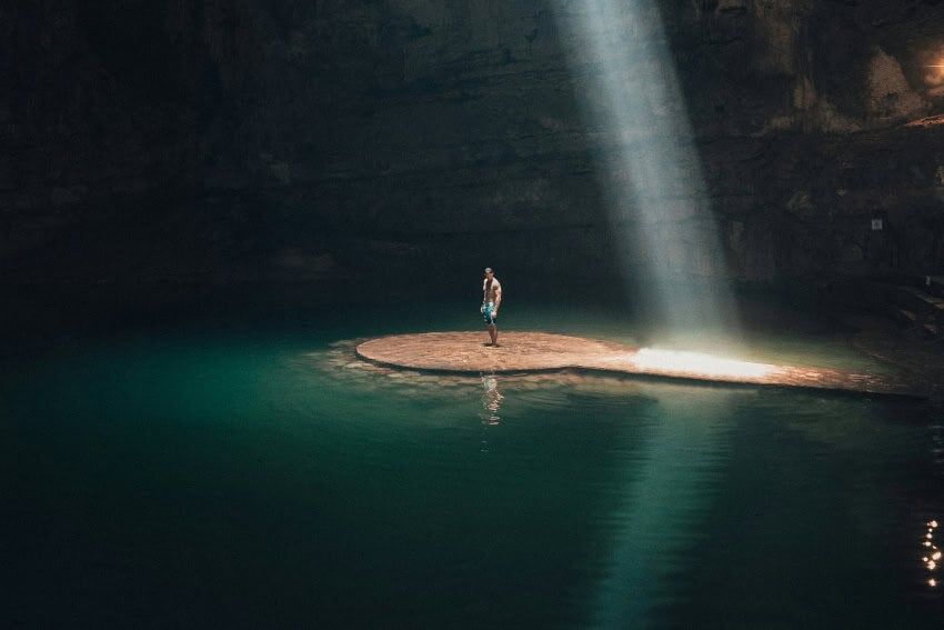
According to the guidebook, Dzitnup features spectacular limestone formations and a shaft of light playing over shimmering water. National Geographic featured this cenote on its cover in 1995, cementing its status as the site that made cenotes famous.
Cenote X'Batun, located 50 kilometers south of Mérida near San Antonio Mulix, offers a different experience. Visitors descend a 20-meter stone staircase to reach an open, low-walled pool where jungle vegetation and bird life come right down to the turquoise water. Colorful kiskadees, orioles and motmots frequent the site, though Palmer warns visitors to watch for slippery steps approaching the water.
Meanwhile, Cenote Xooch has become world-famous through travel photography. Cascading Alamo tree roots fall dramatically into the vast circular cenote's shimmering blue water, creating images that regularly go viral among travel influencers. The clarity and depth make it popular for snorkeling.
Cultural and historical significance
The Yucatán Peninsula has very few permanent surface rivers, making cenotes essential to human settlement. Without these natural water sources, the growth of Maya civilization would have been extremely difficult, according to the National Institute of Anthropology and History.
The Cenote Sagrado at Chichén Itzá exemplifies the spiritual importance of these sites. This roughly circular sinkhole measures 60 meters in diameter with sheer walls dropping 27 meters to the water surface. It served as a major pilgrimage site dedicated to Chaac, the rain god.
Between 1904 and 1911, American consul Edward Herbert Thompson dredged the Sacred Cenote, recovering an extraordinary cache of offerings. Many jade pieces had been deliberately "killed" — ritually broken before being cast into the water as gifts to Chaac.
Palmer's guidebook notes that many cenotes formed following the Chicxulub meteor impact 66 million years ago, which disrupted the limestone platform and created fracture patterns facilitating cave formation — connecting these natural wonders to one of Earth's most significant extinction events.
The underground cave systems contain a unique feature called a halocline, a visible boundary layer where freshwater floats on top of seawater. This boundary varies from approximately 10 meters deep near the coast to 20 meters deep further inland, creating distinct diving conditions throughout the system.
"A Guide to the Cenotes of the Yucatán Peninsula" is expected to be published in the coming weeks.