Hurricane Rachel threatens Pacific coast as first cold front brings rain to northern Mexico
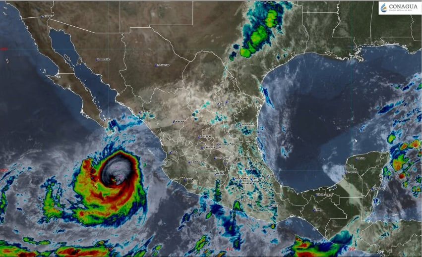
Hurricane Rachel intensified to Category 3 strength Thursday afternoon as it churned through the Pacific Ocean roughly 415 kilometers east-southeast of Cabo Corrientes, Jalisco, threatening Mexico's western coast with torrential rainfall and dangerous flooding conditions.
The storm, which follows closely on the heels of Hurricane Polo, packed maximum sustained winds of 195 km/h with gusts reaching 240 km/h as of early Thursday afternoon. Rachel was located approximately 390 kilometers south of Cabo San Lucas, Baja California Sur, moving westward at 6 km/h.
Meteorologists expect Rachel to strengthen to Category 4 intensity as early as Friday and remain a major hurricane through Saturday. Hurricane-force winds extended outward up to 40 kilometers from the storm's center, while tropical-storm-force winds reached out 260 kilometers.
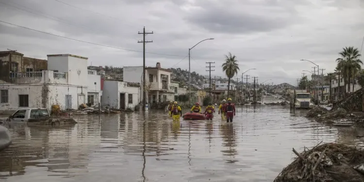
Though Rachel's northwestern trajectory suggests it will not make landfall in Mexico, the National Meteorological Service (SMN) is forecasting very heavy rainfall of up to 75 millimeters through Friday for Nayarit, Sinaloa and southern Baja California Sur. The deluge significantly increases risks of landslides, river flooding and flash floods across the affected regions.
Rachel arrives during what has proven to be an exceptionally active 2026 Pacific hurricane season. NOAA had predicted above-normal activity with a 70% probability, forecasting 15-22 named storms, 9-14 hurricanes, and 5-9 major hurricanes. The season has already produced three Category 5 hurricanes, tying the record set by the 1994, 2002, and 2018 seasons.
The current threat comes just days after Hurricane Polo made two landfalls on September 29. Polo first struck near Las Barrancas in Baja California Sur as a Category 2 hurricane with 110 mph winds, then made a second landfall on the mainland in Sonora east of Guaymas as a Category 1 storm. Polo became the second-most intense Pacific hurricane on record by central pressure at 892 mbar and tied with Hurricane Rick as the third-strongest by maximum sustained winds at 285 km/h. It was also tied as the fourth-strongest hurricane on record to make landfall on the Baja Peninsula, joining only 10 Category 2 or stronger hurricanes to hit the peninsula since record-keeping began in 1949.
The vulnerability of these coastal regions to hurricane impacts has been demonstrated repeatedly in recent years. Hurricane Willa in 2018 affected 33,000 residents in Sinaloa and Nayarit, while Hurricane Nora in 2021 left approximately 355,000 people without power and caused 30 rivers to overflow. Hurricane Pamela in 2021 caused widespread flooding and blackouts across Sinaloa, Nayarit, Durango and Coahuila, resulting in $94.4 million in damage.
State and federal authorities remain on alert in Michoacán, Colima and Jalisco. The Jalisco state government ordered schools closed Wednesday as a precautionary measure, though they reopened Thursday. The National Civil Protection Coordination is urging local authorities and residents in potentially affected areas to monitor updates on Rachel's development closely.
First cold front of the season arrives
Simultaneously, the first cold front of the 2026-2027 season has arrived, bringing additional weather complications to northern and central Mexico. The Arctic high-pressure system, which originated at the North Pole and passed through Canada and the United States, is generating heavy rains, strong wind gusts and temperature drops across several states.
The cold front season officially runs from September 15, 2026 to May 15, 2027, with forecasts predicting between 48 and 56 cold front systems—above the historical average of approximately 44 fronts. These systems primarily enter Mexico through the northeast, where their effects are strongest.
According to the SMN, the cold front's most significant effects will persist for three to four days, impacting Coahuila, Nuevo León, Tamaulipas, San Luis Potosí, Zacatecas, Durango, Chihuahua, Sonora and Aguascalientes. The cold air mass is lowering temperatures and stirring atmospheric instability across the region.
Coahuila, Nuevo León, Tamaulipas, Durango, Zacatecas and San Luis Potosí could receive between 75 and 150 millimeters of rainfall. These northern and central states may also experience wind gusts up to 60-70 km/h, with possible whirlwind formations in northern Coahuila.
While this first cold front marks the beginning of the season, the months of November through February typically see the greatest cold front activity in Mexico. During these peak months, polar air masses cause marked temperature drops, frost, and possible snowfall in mountainous areas.