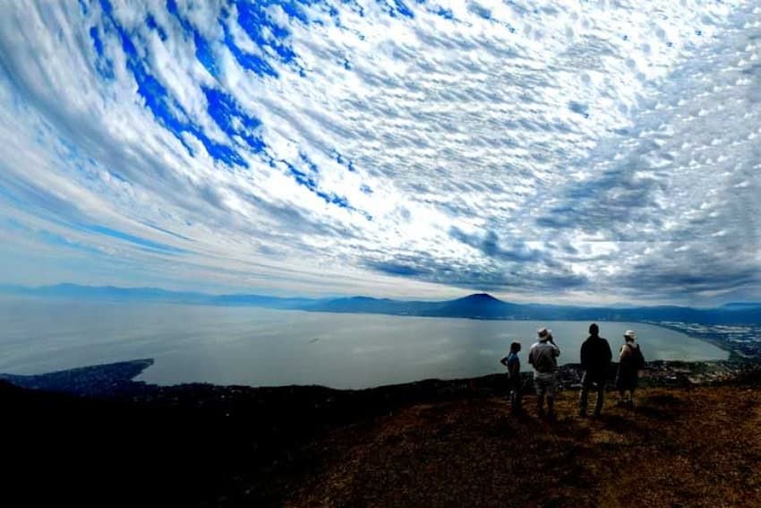
Lake Chapala's mountain trails offer diverse ecosystems and spectacular views
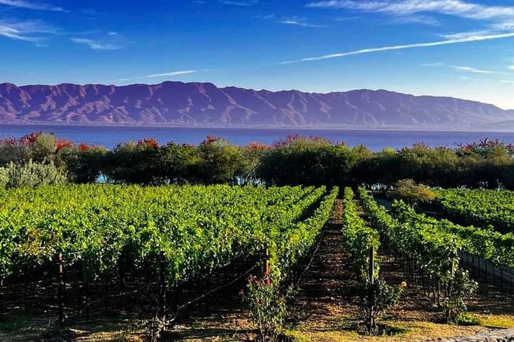
Residents living along the shores of Lake Chapala enjoy immediate access to one of Mexico's premier hiking destinations. Mexico's largest natural freshwater lake, spanning approximately 80 kilometers from east to west and covering 1,100 square kilometers, sits at an elevation of 1,524 meters above sea level on the Mexican Plateau, roughly 45 kilometers southeast of Guadalajara.
The lakeside communities host around 100 kilometers of trails leading to scenic ridges and peaks, creating what many consider a hiker's paradise. The area's year-round average temperature of 19°C, combined with its elevation and tropical latitude, provides comfortable hiking conditions throughout most of the year, with a rainy season from June to October.
For newcomers to the trail network, connecting with established hiking groups remains the recommended approach. The Lake Chapala Society, founded in 1955 by expatriates and now boasting over 3,000 members, serves as a resource for finding these groups. The organization offers nearly 60 classes, groups, and activities at its garden campus in Ajijic, catering to the area's substantial community of 15,000 to 30,000 American and Canadian residents.
The Caracol Trail: A journey through ecosystems
Among the most striking hikes is the ascent to La Mesa del Ocote, reached via Sendero El Caracol. The trail earns its name from a series of tight switchbacks resembling a snail's spiral, gaining 625 meters in elevation over the course of the climb.
Located 3.3 kilometers north of the Tecnológico Superior de Jalisco's Chapala campus, the trail begins in dense vegetation where narrow paths wind through wild sage and maidenhair ferns. Birds call from lichen-covered trees above moss-carpeted rocks below.
After 3 kilometers, the Caracol switchbacks begin, and the landscape transforms dramatically. The jungle vegetation yields to rocky outcrops, which then give way to an unusual forest of slender, straight oaks. Part of the Sierra de San Juan Cosalá mountain range within Mexico's Trans-Mexican Volcanic Belt, this oak forest features a carpet of golden leaves beneath trees spaced widely enough to allow visibility in all directions.
A massive agave, standing 2 meters tall, serves as a reminder of the Mexican landscape. The trail culminates at El Picacho, the peak, at 2,447 meters elevation, where an antenna marks the summit. From this vantage point, hikers enjoy what many consider the finest view of Lake Chapala and the northern shore communities. The ascent typically takes between 90 minutes and four hours, depending on pace and photography stops.
El Tepalo and the Ceremonial Grounds
A 5-kilometer hike beginning at the north end of Hermenegildo Galeana Street in Ajijic leads toward El Tepalo waterfall and continues to Indigenous ceremonial grounds known as Danza del Sol.
The trail passes tourist trees, or Bursera simaruba, recognized by their red, peeling bark. Called papelillos locally, these trees shed thin, paper-like bark in small curly strips. Hikers also encounter amate trees, or strangler figs, which begin as seeds deposited on tree branches and slowly extend roots to the ground, eventually growing around and strangling their host trees.
Beyond the waterfall, the trail crosses a saddle known as El Pandito. Just 1.3 kilometers west of El Tepalo lies Danza del Sol, a wide, flat, grassy meadow. At its center stands a lone tree adorned with long strips of colored cloth in red, white, blue, green, and yellow. A large circle of stones surrounds the tree, with two igloo-shaped frameworks nearby that serve as temazcales, or sweat lodges, when covered with blankets.
The first Danza del Sol ceremony at this site took place in 1991, bringing together over 100 dancers from Mexico and the United States. The ceremony, traditionally held in July or August, has its roots in Lakota Indigenous tradition, adapted following the First Symposium of the Four Arrows in Mesa, Arizona in 1980. Two buildings near the stone circle provide shelter and food for Indigenous people who travel from across North America to participate in these gatherings.
The ceremonial grounds offer sweeping views of the lake below. A short, steep trail descends back to Ajijic from this location.
Regional significance and resources
Lake Chapala was designated a Ramsar Wetland of International Importance in 2009, recognizing its ecological value in supporting over 150 species of wildlife. The lake, fed principally by the Lerma River from the east and draining through the Río Grande de Santiago to the Pacific Ocean, provides approximately 55% of Guadalajara's drinking water.
A trail guide published in 2021 by Senderos de México describes 25 hikes in the region. The 140-page guide, available in both Spanish and English versions, includes 100 color photographs and 26 maps with contour lines, hiking time estimates, and difficulty ratings.
Beyond Lake Chapala
The region south of Lake Chapala offers additional attractions, including a 350-meter hanging bridge spanning a deep gorge and a river lined with Montezuma cypresses draped in Spanish moss. These sites and 98 more appear in the "Outdoors in Western Mexico" books, currently out of print but available in digital format.